Introduction
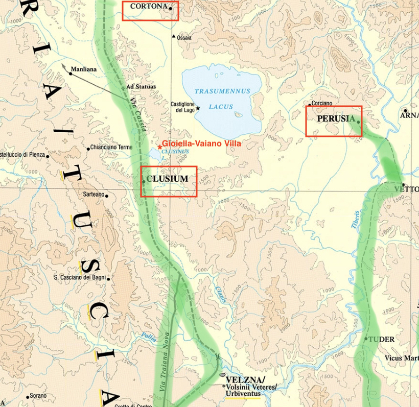
The Gioiella Villa site, also known as “La Villa,” is located on a hill overlooking Lago di Chiusi between the villages of Gioiella and Vaiano (see map). Local residents have long known that there was an ancient site below the modern plough-soil. In fact, the district is labeled as “La Villa” on maps. However, no systematic excavation has been conducted in the area. Preliminary evidence suggests that the site was occupied from the 2nd century BC through at least the late 3rd century AD.
TRAP’s research at the Villa site included a surface survey conducted in 2015 and four seasons of excavation from 2016 to 2019. There were three objectives to the excavations of the villa:
1) to understand the relationship between the environment and human settlement, particularly the role that the Clanis River played in cultural and economic developments in the region;
2) to understand the role Roman villas played in the transformation of the territory from the late Etruscan Period to the late Imperial Period;
3) to understand the changing function of the Gioiella-Vaiano Villa itself over its nearly five centuries of occupation.
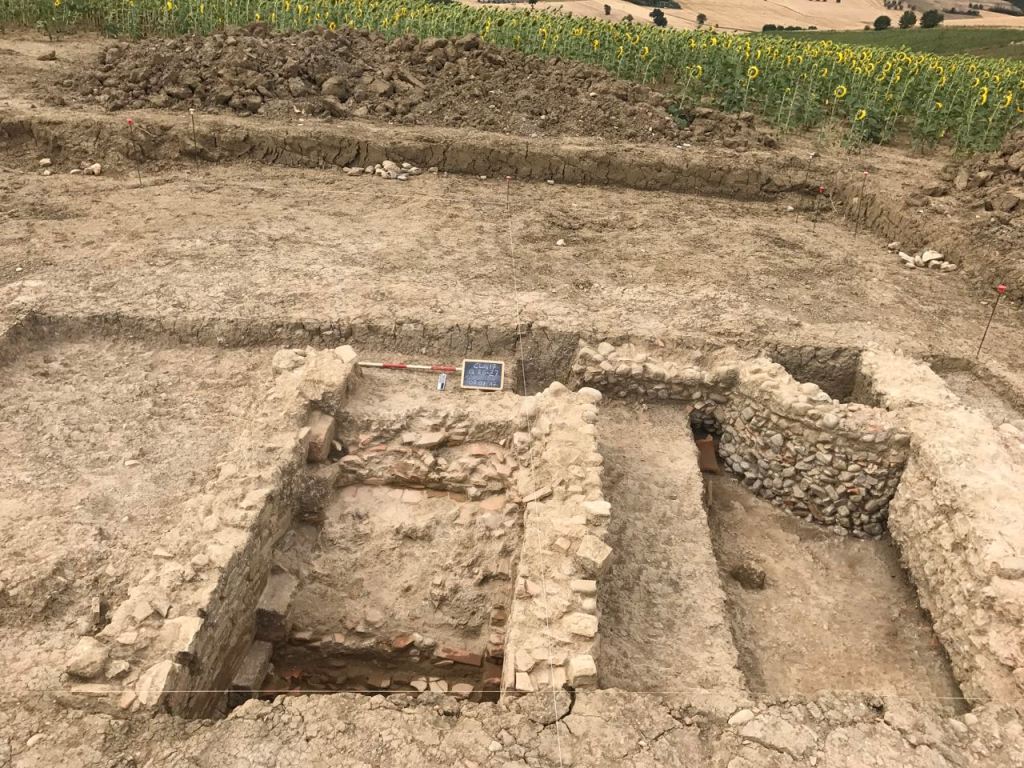
After four excavation campaigns, we now know that the Gioiella-Vaiano Villa was an extensive complex spread out over at least two and possibly three terraces on the slope of the hill overlooking Lago di Chiusi. In the course of its history, the Villa underwent several structural changes as some buildings went out of use or were repurposed for new functions. Excavations to date have focused on investigating the Bath Complex on the Lower Terrace and a monumental building, probably a nymphaeum, in the Central Area. The Villa flourished during the early Imperial Period and its owners may have had connections with the Imperial family.
Surface Survey 2015
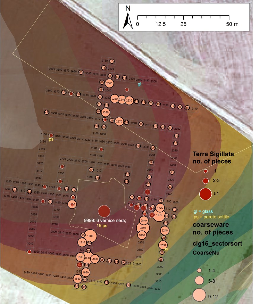
Prior to excavation, the team conducted a surface survey of the site in 2015 (full report available at FOLD&R). Using a controlled sample of 4×4 meter squares, we collected material visible on the surface. After cataloguing the collected objects, we mapped them according to material type and density. The results indicate the possible distribution of activity areas on the site. For example, the following plan shows the density of common ware ceramic pieces (light orange circles) compared to the density of sigillata pieces (red circles). One can see that there are concentrations to the north, the south-east, and the south.
Excavations 2016
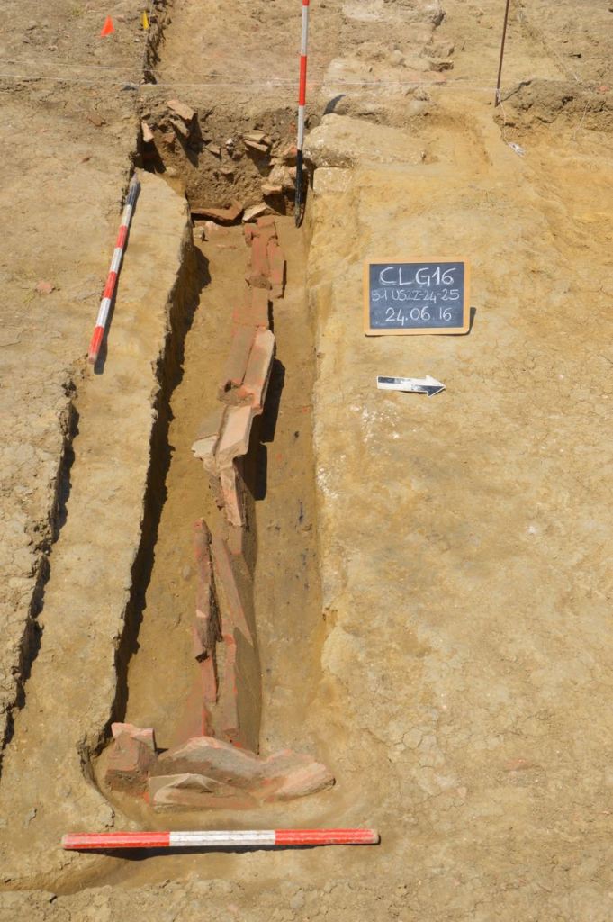
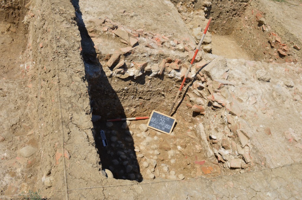
Based on the distribution of materials recovered from the survey in 2015, excavations in 2016 began on the south-east side of the site. It was soon discovered that in this area of the site the natural sediment (which is comprised of deposits of both sand and clay) is very close to the modern surface. The only feature discovered in 2016 is a covered drainage channel that extends from the central part of the site (its origin is not yet known) to the east where it comes to an end. The channel was cut directly into the natural sand and constructed of re-used roof tiles pitched to form a cover. The function of this drainage system has not yet been determined.
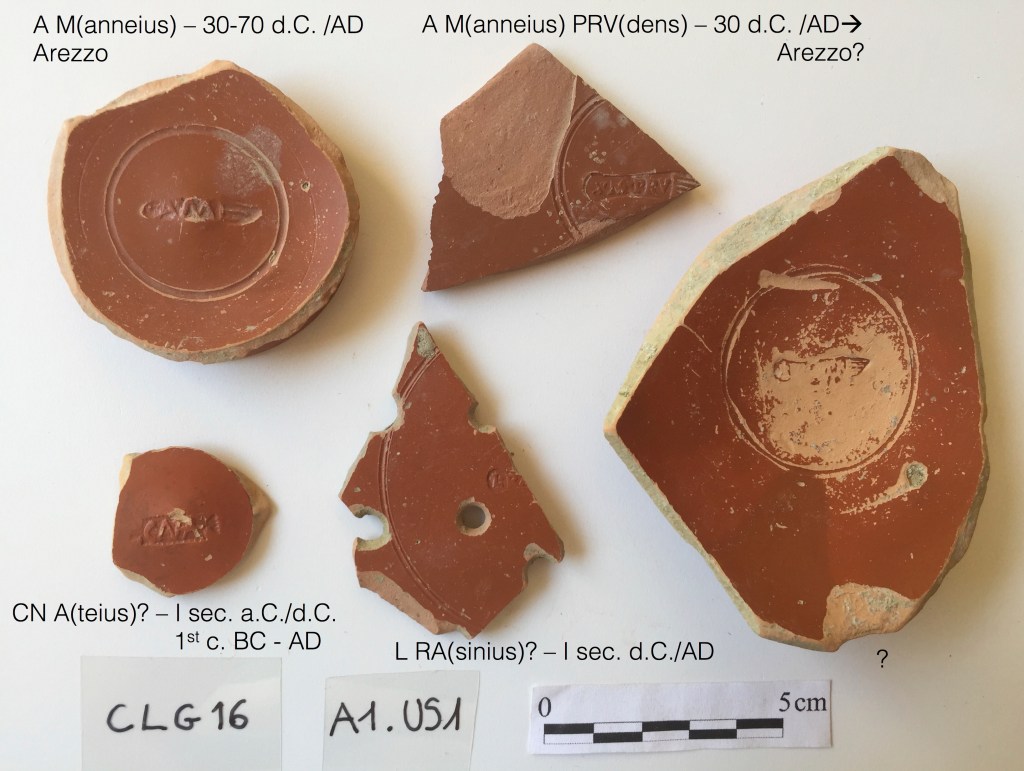
Although the architectural remains uncovered in 2016 were minimal, the ceramics recovered provided further evidence of both the villa’s wealth and its longevity. In addition to pieces of vernice nera, from the 2nd century BC, there are multiple examples of stamped sigillata ware from Arretium (Arezzo).
Excavations 2017-2019
From 2017, excavation focused on two areas of the site: the Lower Terrace to the south-east where the Bath Complex is located and the Central Area, where we now have evidence of a monumental nymphaeum.

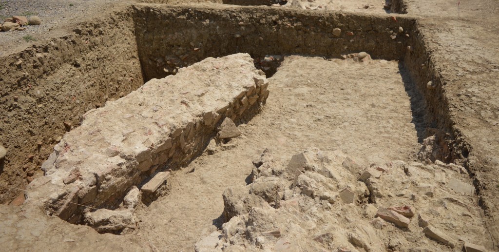
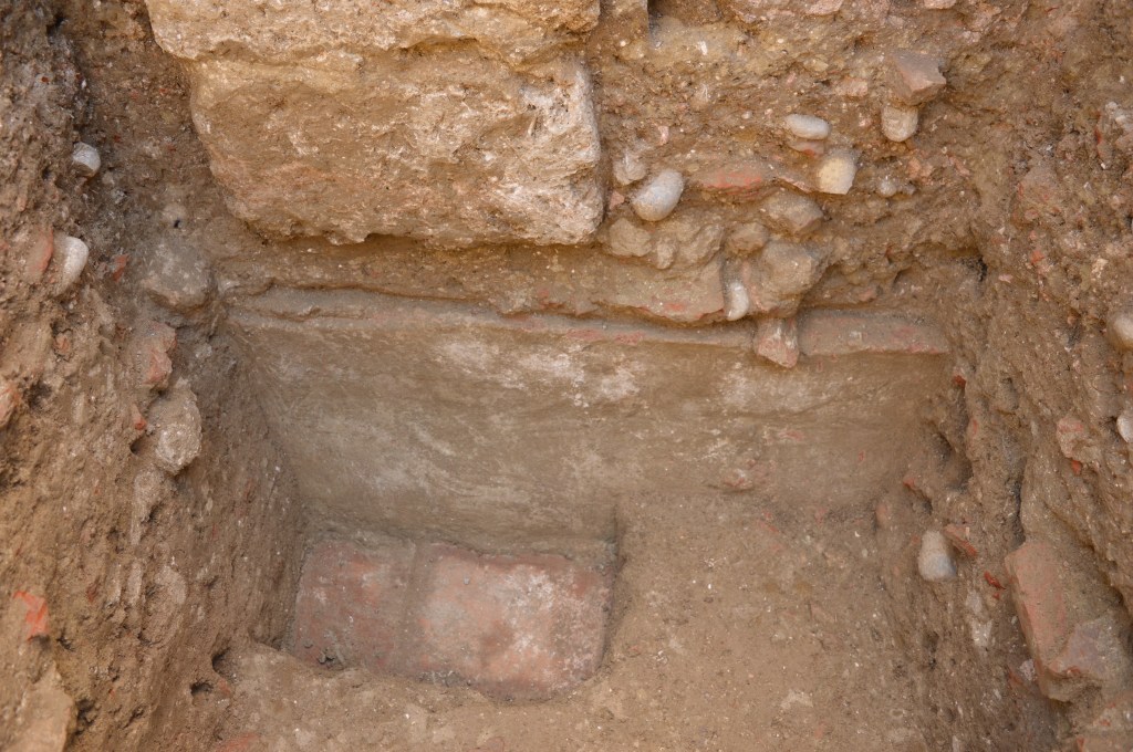
Excavations in 2017 began with one quadrant, E2, on the Lower Terrace and two quadrants, Z6 and Z7, in the Central Area. We had suspected that the villa’s Bath Complex was in the area of E2 because during the survey in 2015 tiles and other building materials particular to a bath were concentrated there, and a trench cut by a back hoe (maybe for irrigation) had exposed part of a wall. The location, down the slope of the hill, also made sense for the placement of a bath complex. In this area the ancient remains are close to the surface and the upper parts of the structures are destroyed, first from abandonment and collapse, and later from agricultural work. What remains are the substructures, in this case the hypocaust (i.e., heating) system of the bath complex. Nevertheless, three rooms could be identified from the 2017 excavation.

The 2018 campaign focused on expanding the bath area to the north to further understand its size and extent. In addition to exposing most of the apsidal room in the bath, we also found that after the bath ceased to be used, the area was repurposed with a drainage system oriented west to east (as we found in 2016). In 2019, we expanded excavations to the west (quadrant D3) to understand the late construction found in 2018 and to begin to connect the Lower Terrace with the Central Area.
The Bath Complex page has details about the plan and construction of the building.
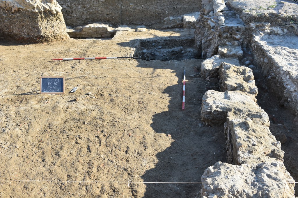
Excavations in the Central Area began in 2017 in two quadrants (Z6 and Z7) where we had recognized a significant concentration of sigillata ceramics during the 2015 survey. After removal of the plough soil, which is deeper in this area than on the Lower Terrace, two sets of walls were exposed: two parallel stone walls to the west and a concrete wall over a cobble wall on the east. Limiting our excavations to exposing the walls, we were surprised at how well preserved they were compared to the walls in the Bath Complex. In Z7 what we first believed was a narrow room is actually a stairway. The chronological relationship between these sets of walls remains unclear. However, both structures continued to the south, thus the 2018 and 2019 campaigns focused on understanding the extent of the structures uncovered in 2017.
The 2018 campaign confirmed that the Central Area structures were part of a larger building. Due to weather conditions and time constraints, the 2018 excavation was limited to the north half of quadrant A7, where the bottom of the stairway was located, and two soundings in quadrant A6, one outside the line of the concrete wall from 2017 and one on the inside.
Excavation was particularly difficult because of the thick layer of building debris that covers this area of the site. Upper strata appear to have been pushed into the area from further up the slope, perhaps an effort of the recent landowners to smooth over the surface of the hill for agriculture, while the levels below that debris represent building collapse from the structure itself.
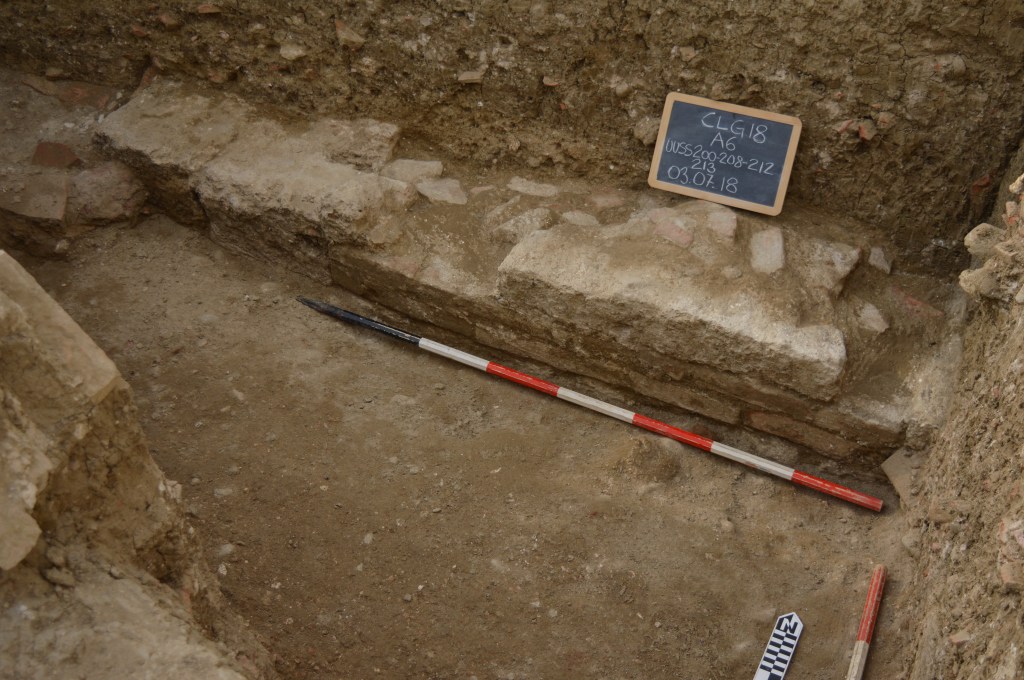
At the end of the 2018 campaign the excavations reached the bottom of the stairway in quadrant A7 and a tile floor in A6. The floor was built against a thick, but short, wall made of cocciopesto, water-proof cement. Above the cocciopesto wall were two large limestone blocks but the relationship between those and the walls we identified in 2017 was not certain. At that time we hypothesized that the large structure in the Central Area was likely related to the production of wine or oil, perhaps in a vaulted room accessible by the stairs and equipped with a water-proof basin to catch the liquid from pressing grapes or olives.
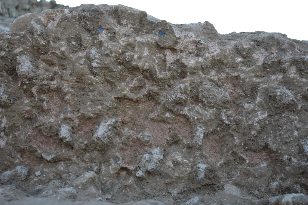
The 2019 campaign began with an attempt to excavate quadrants A6, A7, B6, and B7 to the level of the tile floor exposed at the end of 2018. However, it quickly became apparent that the north-south wall uncovered in 2017-2018 continued to the south and extended beyond the line of B6. This realization combined with the difficulty of excavating the thick debris levels in the upper strata led to the decision to work only in the eastern half of the building. The construction of the east wall also indicated that we were no longer digging a humble building for processing agricultural products but rather a sophisticated building designed for luxury (otium) rather than production (negotium). The walls feature alternating pilasters and niches. The pilasters appear to have been faced with painted plaster in vibrant colors (reds and yellows), while the niches were decorated with plaster inset with small rocks and pieces of blue-glass (pasta vitrea) giving the impression of a natural rocky surface, like the interior of a cave. Moreover the basin that we first identified in 2018 is actually a pool for water, and the stairway may have been for a cascading water feature.
The size, design, and decoration of the building in the Central Area all point to the conclusion that this structure is a monumental nymphaeum, a type of Roman building that includes water features, in this case a pool and possible water-fall, and is often decorated to give the impression that one is in a natural space, like a cave.
The Nymphaeum page provides details of the building’s plan, decoration, and possible function in the context of the villa.
Excavation at the site ended in 2019. While there are still many unanswered questions about the history and function of the Roman Villa at Gioiella, there is no doubt that the site has contributed to our understanding of Roman land use in the lower Valdichiana and, moreover, has established the fact that the Romans constructed luxury villas in this area of Central Italy.
